Recreation near Historic Wallace Idaho
| The area around the historic mining town of Wallace Idaho is a full-season mountain recreation paradise. Winter embraces alpine and cross-country skiing, snowboarding, snowshoeing and snowmobiling. River and lake fishing, mountain biking and climbing, river rafting and kayaking, golf, hiking, backpacking, camping, and motorized exploration (with Jeeps, ATV's, dirt bikes, etc.) occupy outdoor recreation enthusiasts from spring to fall. Bow, rifle and muzzleloader hunting for deer and elk is naturally popular each fall. Black bears are hunted during the fall and spring, while mountain lions are hunted from September through March. |
|---|
 This page offers a taste of things to do
less than an hour's drive from Wallace... and will always
be under construction.
This page offers a taste of things to do
less than an hour's drive from Wallace... and will always
be under construction.
|
|---|
Photo Presentations on this page and
links to recreational "websuites" where several pages detail the specific attraction.
The last update to a section or index page is noted parenthetically.
|
|
||
|---|---|---|---|

|
|
||

| If you have pictures of these areas
that you would like to share, send
JPG's with descriptions
to me at
greg4mss@yahoo.com.
I will display them in this or
an evolved format with your name, email and/or website
displayed according to your wishes.
Your favorite photo that is not descriptive of a particular place,
yet captures a mood or moment in North Idaho industry or recreation,
could be appreciated by all if it was in the
Photo Album.
Naturally, photos taken at festivals could be best used as
contributions to theSilver Valley Festivals
page or to a special subpage. Thank you, Greg Marsh |
|---|
|
![]()
| The Trail of the Coeur d'Alenes bike path follows the Union Pacific Railroad's right-of-way 72 miles from Mullan to Plummer. This page presents some of the photos taken along the way. | |
|---|---|
 The smooth new path is easy traveling for those on foot, bikes, or roller blades. |
 All the railroad bridges have been resurfaced for bikes. |
 Tranquil wetlands lie between the Trail and the Coeur d'Alene River. |
 Sometimes the view from a railroad bridge makes you pause. |
 The small treasures you encounter include beaver homes. |
 The large panoramas are breathtaking, especially as dusk approaches. |
 Lake Coeur d'Alene is naturally a high point of the adventure. |
 Most of the trail is far away from habitation, giving you both solitude and exercise. Pack a lunch. |
![]()
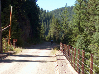
| The Route of the Hiawatha is a scenic section of abandoned rail-bed from the Milwaukee Road that The Taft Tunnel Preservation Society and the U.S. Forest Service have turned into a world class non-motorized trail. More photos from this trip are presented as a slide show. Opening the trail map in a separate window may help visualize the adventure. | |
|---|---|
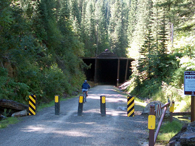 New in the 2001 season, the East Portal of the Taft Tunnel is located 2¼ miles south of Interstate 90 at Montana Exit 5 ("Taft"). |
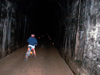 The photographers, Tim and Julie, realize that "the light at the end of the tunnel" is VERY far away indeed! 1.8 miles to be exact. |
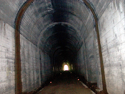 After riding forever, the end appears to be close... but then everything is so disorientating... and cool. As in: 50° on an 80° day. |
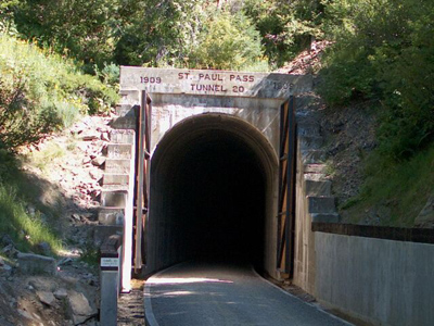 The Taft Tunnel is also known as The St. Paul Pass Tunnel. This West Portal is also known as Roland, Idaho: once a railroad town, now a shuttle stop. |
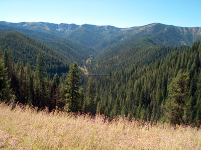 Looking across to the Clear Creek headwaters of the North Fork of the St. Joe River, you can see the 760 foot long Clear Creek Trestle in midview. |
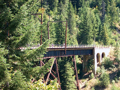 Small Creek Trestle (515 feet long, 120 feet high) and the six other trestles on the bike trail were built at enormous expense between 1906 and 1909. |
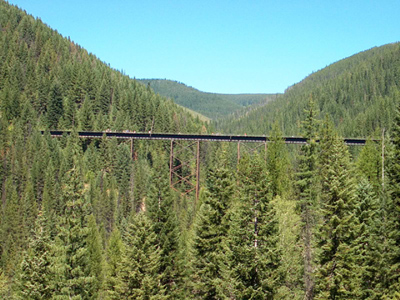 Montana lies over the Bitterroot Divide above Kelly Creek Trestle (850 feet long, 230 feet high), which is near an extinct railroad town called Adair. |
 Riding west from Clear Creek Trestle, it is about five miles down Loop Creek to the bottom trailhead and shuttle stop called Pearson. This is just off Forest Highway 456 that connects Wallace and Avery. |
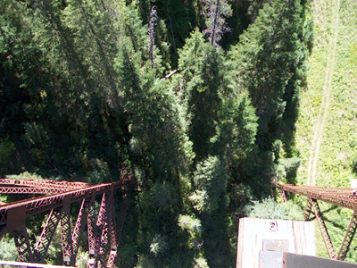 Clear Creek Trestle is really not that scary... until you decide to look 220 feet straight down to the nearest road. |
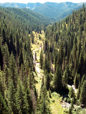 However, if you look southwest from Clear Creek
Trestle, you see just another reason why the
Route of the Hiawatha may be the most scenic mountain
bike trail in the world.
However, if you look southwest from Clear Creek
Trestle, you see just another reason why the
Route of the Hiawatha may be the most scenic mountain
bike trail in the world.
|
![]()
|
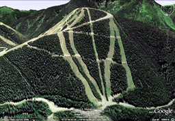
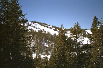
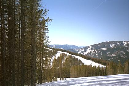
Silver Mountain Ski and Recreation
Area lies above the
towns of Wardner and Kellogg and is accessed by gondola
from I-90, in the middle section of the
Silver Valley.
Saturday, May 14, 2011, snow report for Silver Mountain The 2010/11 Snow Log and Commentary for both Silver Valley ski areas was last updated on Sunday, October 15, 2017. |
|
|---|---|
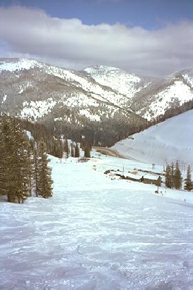
 Looking down to where the gondola starts its 19 minute journey, 3 blocks from I-90 in Kellogg |
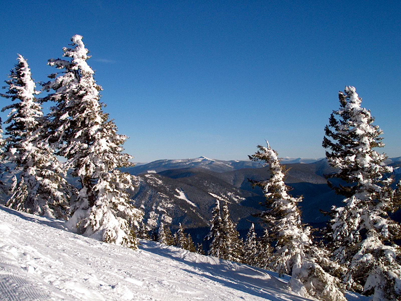
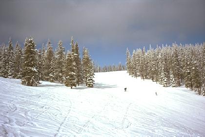
 Silver Mountain is characterized by deep powder, few people, and awesome views. |
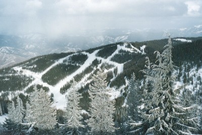 Silver Mountain is an ideal place to learn skiing or snowboarding because beginners and experts are separated by the terrain. |
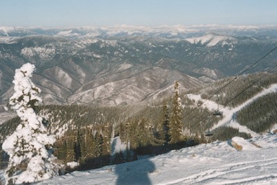 Looking north over the Silver Valley, past the North Fork of the Coeur d'Alene River, toward the Cabinet Range and Canada. |
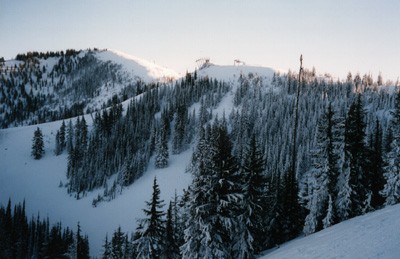
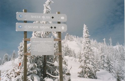 Silver Mountain is famous for its DEEP powder, especially in the "Hike and Ski" EXPERT-ONLY area on the back side of Mt. Wardner. |
 Typical powder day at Silver Mountain, looking at Mt. Wardner's expert terrain... but the REALLY DEEP POWDER is on the back side! A reward for those tough enough to hike to the summit. |
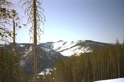
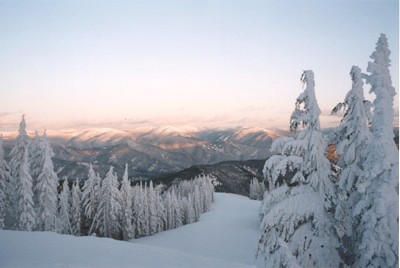 Looking east past Big Creek and Mt. Stevens toward Lookout Pass Ski and Recreation Area and Montana in the distance. Skiing and Snowboarding doesn't get better than in the Silver Valley! |
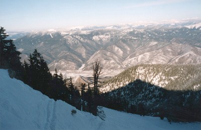
 Looking south from the top of Silver Mountain one can see the Saint Joe River Valley in the distance. This wild and scenic river basin is paradise to fishers and other outdoor enthusiasts from spring to fall. |
 Racing downhill all day long at Silver Mountain without the benefit of lift line intermissions can be exhausting as well as exhilarating. Good thing your lodging in historic Wallace is only a dozen miles away. |
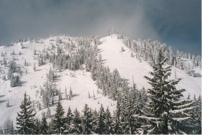
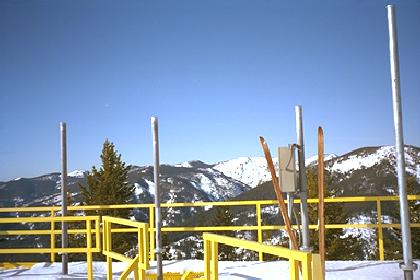
 This view to the east shows Mt. Stevens (6838') in the distance and East Ridge to the left, with the Big Creek drainage in mid range. The proposed new quads will go from the valley floor to the top of East Ridge. Straight down is "South of the Border" (OUT OF BOUNDS... for now). |
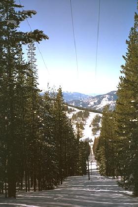
![]()
|
Tuesday, July 14, 2026, snow report for Lookout Pass Ski Area The 2014/15 Snow Log and Commentary for both Silver Valley ski areas was last updated on Sunday, October 15, 2017. |
|
|---|---|
|
The photos shown below were taken in 1994, before expansion began.
|
|
 The lodge at Lookout Pass straddles the border just off Interstate 90. |
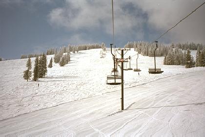 Lookout Pass is characterized by deep powder and few people. |
 Lookout Pass is an ideal place for kids to learn to ski. Their "Free Ski School" for local kids has been in operation for over 50 years. |
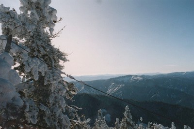
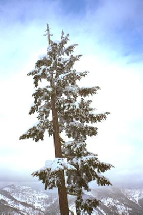
 Looking north toward Sunset Peak and the Glidden Lakes backcountry on the other side of ridge. |
 Lookout Pass is famous for its DEEP powder. If almost a foot of light powder falls at Silver Mountain, expect more than foot at Lookout Pass. |
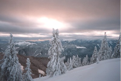
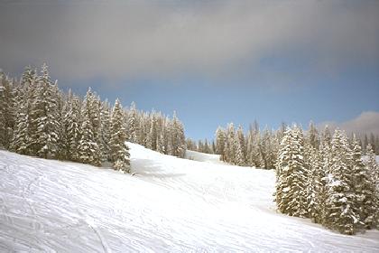 Typical day in March at Lookout Pass. |
 Looking east to Montana from Lookout Pass with Beacon Mountain on the left... a great place to cross-country ski. |
 Looking south from the top of Lookout Pass one can see the start of the St. Regis Lake Basin. A wondrous roadless place. Things look different now, however, as Buzzards Valley, now called B-52, and featuring a radical Snowboard Terrain Park with nine huge hits, was added for the 1998/99 season. |
 Racing downhill toward the lodge with no fear of running into anyone is the normal experience at Lookout. |
 Much of the 50 acre Buzzards Valley expansion in 1998 added expert tree skiing and boarding to the area's charm. A wide beginner run, Hoot Owl, was cut through part of this area for the 2001/02 season, but the best tree ski/boarding areas remain for the adventurous. |


![]()
| Cross Country Skiing on the Idaho-Montana border, at the east end of the Silver Valley | |
|---|---|
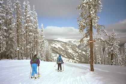
 The trip up Beacon Mountain begins at Lookout Pass. |
 Soon Silver Mountain Ski Area can be seen in the distance. |
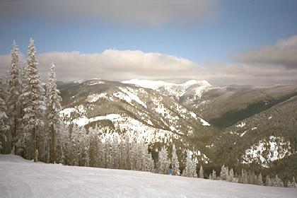
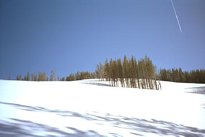 Looking up at the untracked March powder on Beacon Mountain. |
 Looking back at Lookout Pass Ski Area from Beacon Mountain. |
 Looking across to Sunset Peak from the top of Beacon Mountain. |
 The Mullan weather station is at the top of Beacon Mountain. This photo was taken in 1993, before it was completely built. |
|
Wallace History October 08, 2017 |
Modern Wallace October 10, 2008 |
|---|---|
|
Wallace Relocation January 17, 2018 |
Photo Album December 29, 2003 |
|
Wallace Festivals August 16, 2018 |
Wallace Business August 06, 2018 |
|
Wallace Homepage August 06, 2018 |
Today's Weather (updated every hour) January 02, 2018 |
| Dates indicate when the content or structure of a page was modified. This Wallace RECREATION page was last modified on November 23, 2015. | |